
Fil:Australien, karta, Nordisk familjebok Kap Leeuwin.jpg

Storlek på förhandsvisningen: 702 × 600 pixlar. Andra upplösningar: 281 × 240 pixlar | 562 × 480 pixlar | 899 × 768 pixlar | 1 156 × 988 pixlar.
Originalfil (1 156 × 988 pixlar, filstorlek: 546 kbyte, MIME-typ: image/jpeg)
| Denna fil tillhandahålls av Wikimedia Commons. Informationen nedan är kopierad från dess filbeskrivningssida. |
Sammanfattning
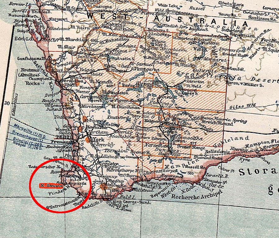
| Beskrivning | southwestern part of Australia, indicating Cape Leeuwin. From a pre-1904 map. |
| Datum | före 1904 |
| Källa | https://runeberg.org/nfbb/0252.html |
| Skapare | unknown; editing by Ibn Battuta |
| Andra versioner | map before cropping (= entire Australia) and without marker: Image:Australien, karta, Nordisk familjebok.jpg |
Denna bild publicerades första gången i den första (1876–1899), andra (1904–1926) eller tredje (1923–1937) upplagan av Nordisk familjebok. Upphovsrätten för det verket har gått ut, och bilderna är fria att använda.
|
This image (or other media file) is in the public domain because its copyright has expired and its author is anonymous.
This applies to the European Union and those countries with a copyright term of 70 years after the work was made available to the public and the author never disclosed their identity. Important: Always mention where the image comes from, as far as possible, and make sure the author never claimed authorship. |
 | |
 |
Note: In Germany and possibly other countries, certain anonymous works published before July 1, 1995 are copyrighted until 70 years after the death of the author. See Übergangsrecht. Please use this template only if the author never claimed authorship or their authorship never became public in any other way. If the work is anonymous or pseudonymous (e.g., published only under a corporate or organization's name), use this template for images published more than 70 years ago.
For a work made available to the public in the United Kingdom, please use Template:PD-UK-unknown instead.
|
Filhistorik
Klicka på ett datum/klockslag för att se filen som den såg ut då.
| Datum/Tid | Miniatyrbild | Dimensioner | Användare | Kommentar | |
|---|---|---|---|---|---|
| nuvarande | 8 april 2007 kl. 10.59 | | 1 156 × 988 (546 kbyte) | Ibn Battuta | red markers, should be more visible |
| 8 april 2007 kl. 10.50 |  | 1 156 × 988 (545 kbyte) | Ibn Battuta | {{Information |Description=southwestern part of Australia, indicating Cape Leeuwin. From a pre-1904 map. |Source=http://runeberg.org/nfbb/0252.html |Date=before 1904 |Author= |Permission= |other_versions=map before cropping (= entire |
Filanvändning
Följande sida använder den här filen:
Global filanvändning
Följande andra wikier använder denna fil:
- Användande på br.wikipedia.org
- Användande på de.wikipedia.org