
Fil:Interstate 69 map.png

Storlek på förhandsvisningen: 800 × 450 pixlar. Andra upplösningar: 320 × 180 pixlar | 640 × 360 pixlar | 1 024 × 575 pixlar | 1 280 × 719 pixlar | 2 205 × 1 239 pixlar.
Originalfil (2 205 × 1 239 pixlar, filstorlek: 119 kbyte, MIME-typ: image/png)
| Denna fil tillhandahålls av Wikimedia Commons. Informationen nedan är kopierad från dess filbeskrivningssida. |
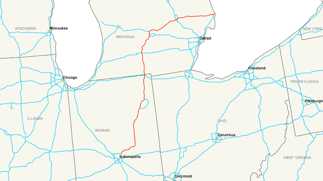
| Beskrivning | Map of Interstate 69 |
| Datum | |
| Källa | Eget arbete |
| Skapare | Nick Nolte |
| Tillstånd (Återanvändning av denna fil) |
Own work, all rights released (Public domain) |

|
Denna bild (eller alla bilder i denna artikel eller kategori) bör återskapas med hjälp av vektorgrafik som en SVG-fil. Detta har flera fördelar; se Commons:Media for cleanup för mer information. Om det redan existerar en SVG-version av denna bild, var vänlig och lägg upp den. Efter att en SVG-version lagts upp, ersätt denna mall med {{vector version available|nytt bildnamn.svg}} på denna sida.
|
Jag, upphovsrättsinnehavaren av detta verk, publicerar härmed det under följande licens:
| Denna fil har gjorts tillgänglig under licensen Creative Commons CC0 1.0 Universal Public Domain Dedication. | |
| Personen som kopplade ett verk till detta dokument har tillägnat arbetet till Allmänheten genom att, i den utsträckning som tillåts i lag, avstå från alla sina rättigheter till verket i hela världen som han eller hon skulle haft för verket enligt upphovsrätten och alla relaterade eller närliggande juridiska rättigheter. Du kan kopiera, modifiera, sprida och visa upp verket, även för kommersiella ändamål, utan att fråga efter godkännande från upphovsmannen.
|
Filhistorik
Klicka på ett datum/klockslag för att se filen som den såg ut då.
| Datum/Tid | Miniatyrbild | Dimensioner | Användare | Kommentar | |
|---|---|---|---|---|---|
| nuvarande | 26 november 2015 kl. 12.00 | | 2 205 × 1 239 (119 kbyte) | Imzadi1979 (public) | Reverted to version as of 05:15, 16 July 2006 (UTC) |
| 26 november 2015 kl. 11.46 |  | 798 × 1 084 (54 kbyte) | BasilLeaf | The map File:Interstate 69 map.png already exists under the name File:I69--Michigan-Indiana.png, and the name '''File:Interstate 69 map.png''' is the generic '''File:Interstate # map.png''' associated with the infobox used in these articles,... | |
| 26 november 2015 kl. 07.00 |  | 2 205 × 1 239 (119 kbyte) | Imzadi1979 | Reverted to version as of 05:15, 16 July 2006 (UTC); restoring original, upload any new maps under a new title please | |
| 26 november 2015 kl. 05.47 |  | 798 × 1 084 (54 kbyte) | BasilLeaf | full map | |
| 16 juli 2006 kl. 07.15 |  | 2 205 × 1 239 (119 kbyte) | Stratosphere | {{Information| |Description=Map of Interstate 69 |Source=Own Work |Date=July 15, 2006 |Author=Nick Nolte |Permission=Own work, all rights released (Public domain) |other_versions= }} {{PD-self}} Category:U.S. Interstate Maps[ |
Filanvändning
Följande sida använder den här filen:
Global filanvändning
Följande andra wikier använder denna fil:
- Användande på de.wikipedia.org
- Användande på en.wikipedia.org
- Användande på en.wikibooks.org
- Användande på eu.wikipedia.org
- Användande på fa.wikipedia.org
- Användande på it.wikipedia.org
- Användande på ko.wikipedia.org
- Användande på nl.wikipedia.org
- Användande på ru.wikipedia.org
- Användande på vi.wikipedia.org