
Fil:Tasmania in Australia map.png
Det finns ingen version med högre upplösning.
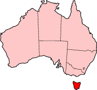
Tasmania_in_Australia_map.png (200 × 186 pixlar, filstorlek: 11 kbyte, MIME-typ: image/png)
| Denna fil tillhandahålls av Wikimedia Commons. Informationen nedan är kopierad från dess filbeskrivningssida. |
Localization of Tasmania in Australia

|
Tillstånd ges att kopiera, distribuera och/eller modifiera detta dokument under villkoren i GNU Free Documentation License, Version 1.2 eller senare version publicerad av Free Software Foundation, utan oföränderliga avsnitt, framsidestexter eller baksidestexter. En kopia av licensen ingår i avsnittet GNU Free Documentation License. |
| Denna fil har gjorts tillgänglig under licensen Creative Commons Erkännande-Dela Lika 3.0 Generisk | ||
| ||
| Detta licenstillägg lades till till denna fil som en del av GFDL:s licensuppdatering. |

|
En vektorversion av denna bild (SVG) finns tillgänglig.
Den skall användas istället för denna rasterbild, när det är fördelaktigt. File:Tasmania in Australia map.png → File:Tasmania in Australia.svg
För mer information om vektorgrafik, se artikeln Commons transition to SVG (engelska). Det finns också information om MediaWikis stöd för SVG-bilder (engelska). |
 |
History on English Wikipedia
- (delete all) (current) 23:20, 22 February 2004 Morwen (Talk | contribs | block) 200×186 11 KB
- (delete this) (revert) 08:45, 10 May 2003 Tim Starling (Talk | contribs | block) 200×181 4 KB Created by me based on Geoscience Australia data
Filhistorik
Klicka på ett datum/klockslag för att se filen som den såg ut då.
| Datum/Tid | Miniatyrbild | Dimensioner | Användare | Kommentar | |
|---|---|---|---|---|---|
| nuvarande | 12 december 2004 kl. 17.08 | | 200 × 186 (11 kbyte) | Mschlindwein | Localization of Tasmania in Australia |
Filanvändning
Inga sidor använder den här filen.
Global filanvändning
Följande andra wikier använder denna fil:
- Användande på en.wikipedia.org
- Coat of arms of Tasmania
- List of highways in Tasmania
- James Boag's Premium
- Tasmanian Conservation Trust
- Butlers Gorge Power Station
- Tasmania 40° South
- Colonial Secretary of Tasmania
- Office of the Tasmanian Economic Regulator
- Anthony Fenn Kemp
- Tasmanian Ports Corporation
- Agfest
- Mona Foma
- William Collins (colonist)
- Grecian (1824 ship)
- Cygnet Folk Festival
- Tasmanian Freight Equalisation Scheme
- Template:Tasmania-stub
- Bulbine crassa
- Currie Lighthouse
- Goose Island Lighthouse
- Electoral division of Westmorland
- Lune River, Tasmania
- Tasmanian University Football Club
- 2014 Tasmanian Legislative Council periodic election
- Tasmanian Electoral Commission
- Hope and Anchor Tavern
- Gormanston railway station, Tasmania
- 2015 Tasmanian Legislative Council periodic election
- Tasmanian Central Highlands
- Tasmanian Northern Midlands
- Tasmanian Northern Slopes
- Tasmanian West
- Tasmanian South East
- Tasmanian Southern Ranges
- King bioregion
- Ben Lomond bioregion
- Nieterana Power Station
- Deal Island Lighthouse
- Furneaux bioregion
- Tasmanian Government Personal Information Card
- 2018 Hobart floods
- Patterdale and Nile Farm
- Tasdance
- Lea Tree
- Solicitor-General of Tasmania
- Användande på hif.wikipedia.org
- Användande på hu.wikipedia.org
- Användande på id.wikipedia.org
- Användande på ja.wikipedia.org
- Användande på nv.wikipedia.org
Visa mer globalt användande av denna fil.