
Fil:Un-tanzania.png
Originalfil (2 317 × 2 652 pixlar, filstorlek: 1,88 Mbyte, MIME-typ: image/png)
| Denna fil tillhandahålls av Wikimedia Commons. Informationen nedan är kopierad från dess filbeskrivningssida. |
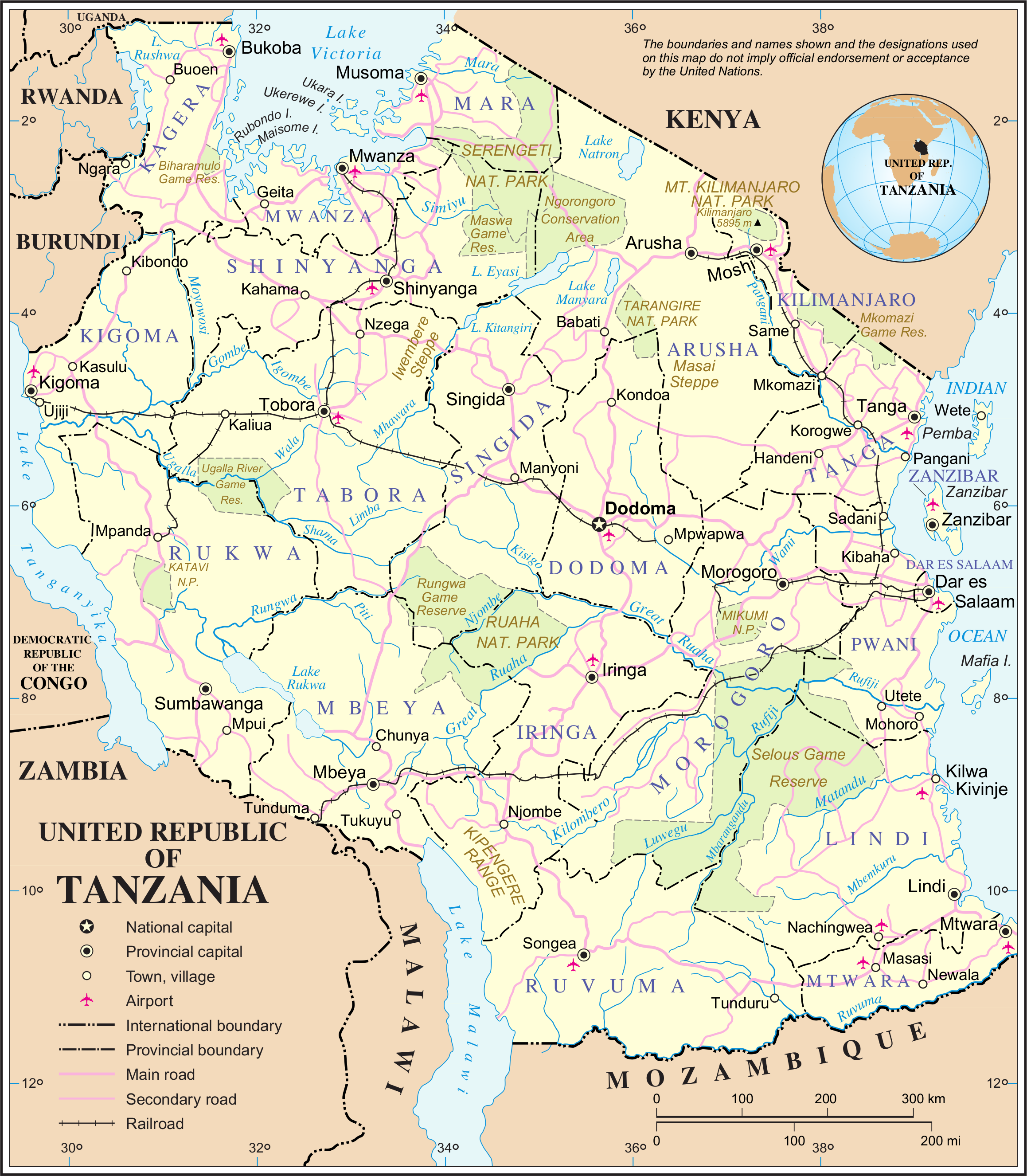
| This image is a map derived from a United Nations map.
Unless stated otherwise, UN maps are to be considered in the public domain. This applies worldwide. UN maps are, in principle, open source material and you can use them in your work or for making your own map. UN requests however that you delete the UN name, logo and reference number upon any modification to the map. Content of your map will be your responsibility. You can state in your publication, if you wish, something like: based on UN map … (map name, map number, revision number and date). See: Geospatial Information Section. And: Geospatial, location data for a better world. |
 |
Filhistorik
Klicka på ett datum/klockslag för att se filen som den såg ut då.
| Datum/Tid | Miniatyrbild | Dimensioner | Användare | Kommentar | |
|---|---|---|---|---|---|
| nuvarande | 22 oktober 2007 kl. 02.17 | | 2 317 × 2 652 (1,88 Mbyte) | Jeroen | {{UN map}} Category:Maps of Tanzania |
Filanvändning
Inga sidor använder den här filen.
Global filanvändning
Följande andra wikier använder denna fil:
- Användande på az.wikipedia.org
- Användande på da.wikipedia.org
- Användande på el.wikipedia.org
- Användande på en.wikipedia.org
- Användande på es.wikipedia.org
- Användande på fr.wikipedia.org
- Användande på gl.wikipedia.org
- Användande på it.wikipedia.org
- Användande på nds.wikipedia.org
- Användande på nl.wikipedia.org
- Användande på pl.wiktionary.org
- Användande på roa-tara.wikipedia.org
- Användande på ru.wikipedia.org
- Användande på stq.wikipedia.org
- Användande på uk.wikipedia.org
- Användande på www.wikidata.org