
Fil:Map of Hawaii NA.png
Storlek på förhandsvisningen: 776 × 600 pixlar. Andra upplösningar: 311 × 240 pixlar | 621 × 480 pixlar | 994 × 768 pixlar | 1 280 × 989 pixlar | 2 122 × 1 640 pixlar.
Originalfil (2 122 × 1 640 pixlar, filstorlek: 370 kbyte, MIME-typ: image/png)
| Denna fil tillhandahålls av Wikimedia Commons. Informationen nedan är kopierad från dess filbeskrivningssida. |
Sammanfattning
| Beskrivning |
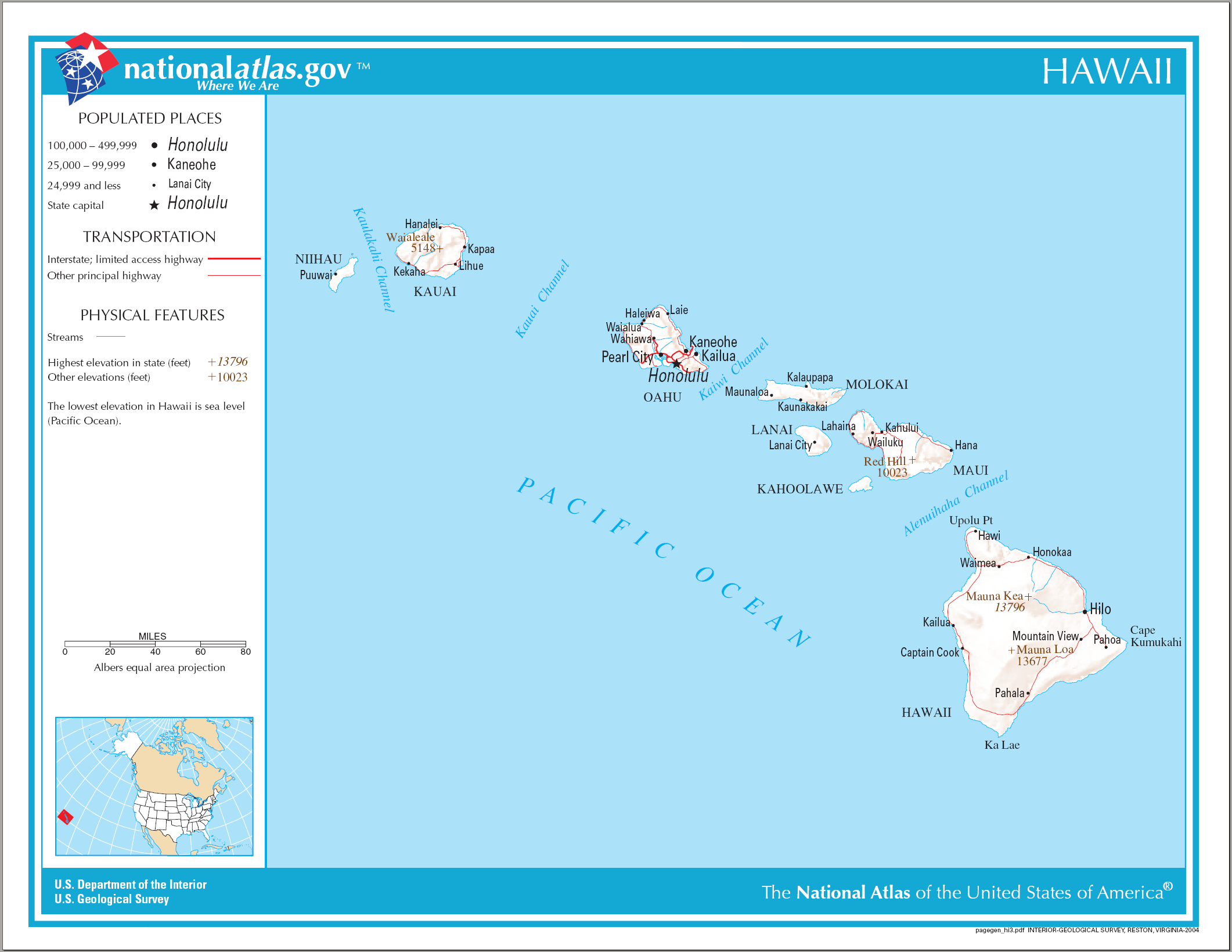
English: Reference Map of Hawaii. |
| Datum | |
| Källa | |
| Skapare | National Atlas of the United States |
| Tillstånd (Återanvändning av denna fil) |
Public domain |
Licensiering
This map was obtained from an edition of the National Atlas of the United States. Like almost all works of the U.S. federal government, works from the National Atlas are in the public domain in the United States.
Online access: NationalAtlas.gov | 1970 print edition: Library of Congress, Perry-Castañeda Library
|
Filhistorik
Klicka på ett datum/klockslag för att se filen som den såg ut då.
| Datum/Tid | Miniatyrbild | Dimensioner | Användare | Kommentar | |
|---|---|---|---|---|---|
| nuvarande | 15 augusti 2006 kl. 12.26 | | 2 122 × 1 640 (370 kbyte) | Huebi~commonswiki | {{Information| |Description=Map of Hawaii |Source=[http://www.nationalatlas.gov National Atlas] }} Category:Maps of the United States Category:Maps of Hawaii {{PD-USGov-Atlas}} |
Filanvändning
Följande sida använder den här filen:
Global filanvändning
Följande andra wikier använder denna fil:
- Användande på af.wikipedia.org
- Användande på als.wikipedia.org
- Användande på cs.wikipedia.org
- Användande på da.wikipedia.org
- Användande på de.wikipedia.org
- Användande på en.wikipedia.org
- Användande på es.wikipedia.org
- Användande på fa.wikipedia.org
- Användande på he.wikipedia.org
- Användande på hr.wikipedia.org
- Användande på hr.wiktionary.org
- Användande på hsb.wikipedia.org
- Användande på hu.wikipedia.org
- Användande på incubator.wikimedia.org
- Användande på it.wikipedia.org
- Användande på kn.wikipedia.org
- Användande på ko.wikipedia.org
- Användande på mk.wikipedia.org
- Användande på ml.wikipedia.org
- Användande på nl.wikipedia.org
- Användande på pam.wikipedia.org
- Användande på pdc.wikipedia.org
- Användande på pl.wikipedia.org
- Användande på pt.wikipedia.org
- Användande på ru.wikivoyage.org
- Användande på sh.wikipedia.org
- Användande på sr.wikipedia.org
- Användande på sw.wikipedia.org
- Användande på te.wikipedia.org
- Användande på zea.wikipedia.org