
Fil:Map of Kentucky highlighting Knox County.svg

Storleken för denna PNG-förhandsvisning av denna SVG-fil: 800 × 345 pixlar. Andra upplösningar: 320 × 138 pixlar | 640 × 276 pixlar | 1 024 × 441 pixlar | 1 280 × 551 pixlar | 2 560 × 1 103 pixlar | 6 770 × 2 916 pixlar.
Originalfil (SVG-fil, standardstorlek: 6 770 × 2 916 pixlar, filstorlek: 127 kbyte)
| Denna fil tillhandahålls av Wikimedia Commons. Informationen nedan är kopierad från dess filbeskrivningssida. |
Sammanfattning
| Beskrivning |
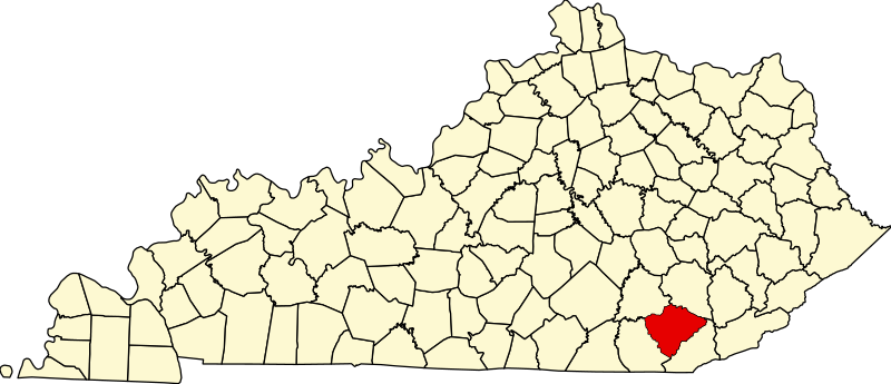
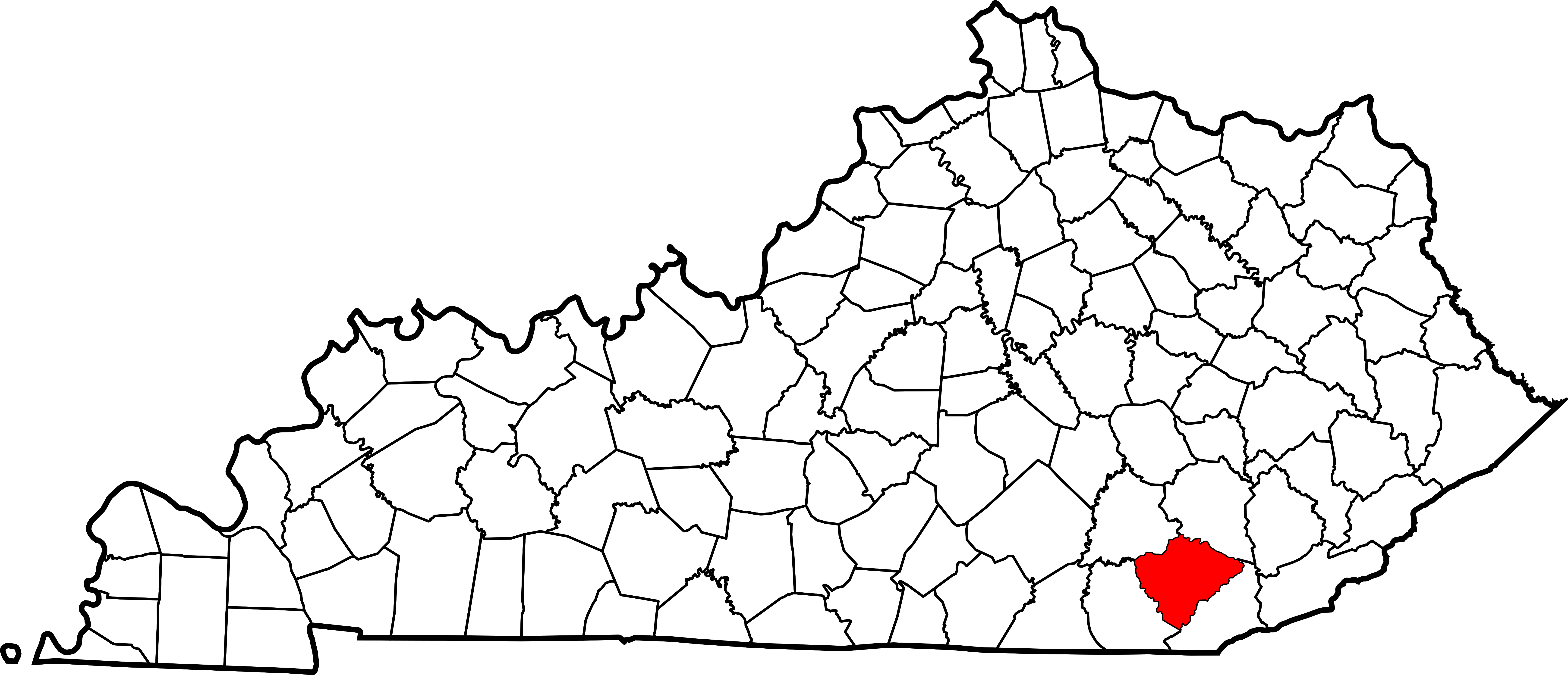
English: This is a locator map showing Knox County in Kentucky. For more information, see Commons:United States county locator maps. |
| Datum | |
| Källa |
Eget arbete: English: The maps use data from nationalatlas.gov, specifically countyp020.tar.gz on the Raw Data Download page. The maps also use state outline data from statesp020.tar.gz. The Florida maps use hydrogm020.tar.gz to display Lake Okeechobee. |
| Skapare | David Benbennick |
Licensiering
| Jag, upphovsrättsinnehavaren till detta verk, släpper detta verk i public domain. Detta gäller globalt. I vissa länder kan detta inte vara juridiskt möjligt; i så fall: Jag ger härmed envar rätten att använda detta verk för alla ändamål, utan några villkor, förutom villkor som lagen ställer. |
Filhistorik
Klicka på ett datum/klockslag för att se filen som den såg ut då.
| Datum/Tid | Miniatyrbild | Dimensioner | Användare | Kommentar | |
|---|---|---|---|---|---|
| nuvarande | 12 februari 2006 kl. 14.22 | | 6 770 × 2 916 (127 kbyte) | David Benbennick | {{subst:User:Dbenbenn/clm|county=Knox County|state=Kentucky}} |
Filanvändning
Följande sida använder den här filen:
Global filanvändning
Följande andra wikier använder denna fil:
- Användande på ar.wikipedia.org
- Användande på azb.wikipedia.org
- Användande på bg.wikipedia.org
- Användande på bpy.wikipedia.org
- Användande på cdo.wikipedia.org
- Användande på ceb.wikipedia.org
- Användande på ce.wikipedia.org
- Användande på cy.wikipedia.org
- Användande på de.wikipedia.org
- Användande på en.wikipedia.org
- Barbourville, Kentucky
- Corbin, Kentucky
- North Corbin, Kentucky
- List of counties in Kentucky
- Eastern Kentucky Coalfield
- Knox County, Kentucky
- Template:Knox County, Kentucky
- User:Nyttend/County templates/KY/2
- National Register of Historic Places listings in Knox County, Kentucky
- Artemus, Kentucky
- Category:Populated places in Knox County, Kentucky
- Kayjay, Kentucky
- Crane Nest, Kentucky
- Trosper, Kentucky
- Warren, Kentucky
- Elys, Kentucky
- Himyar, Kentucky
- Anchor, Kentucky
- Green Road, Kentucky
- Salt Gum, Kentucky
- Scalf, Kentucky
- Hinkle, Kentucky
- Flat Lick, Kentucky
- Slick Lizard Coal Camp, Kentucky
- Powers Coal Camp, Kentucky
- Watch, Kentucky
- Corbin, Kentucky micropolitan area
- Bimble, Kentucky
- Bryants Store, Kentucky
- Cannon, Kentucky
- Dewitt, Kentucky
- Heidrick, Kentucky
Visa mer globalt användande av denna fil.