
Fil:Maricopa County Incorporated and Planning areas Avondale highlighted.svg

Storleken för denna PNG-förhandsvisning av denna SVG-fil: 694 × 599 pixlar. Andra upplösningar: 278 × 240 pixlar | 556 × 480 pixlar | 889 × 768 pixlar | 1 185 × 1 024 pixlar | 2 371 × 2 048 pixlar | 940 × 812 pixlar.
Originalfil (SVG-fil, standardstorlek: 940 × 812 pixlar, filstorlek: 1,05 Mbyte)
| Denna fil tillhandahålls av Wikimedia Commons. Informationen nedan är kopierad från dess filbeskrivningssida. |
Sammanfattning
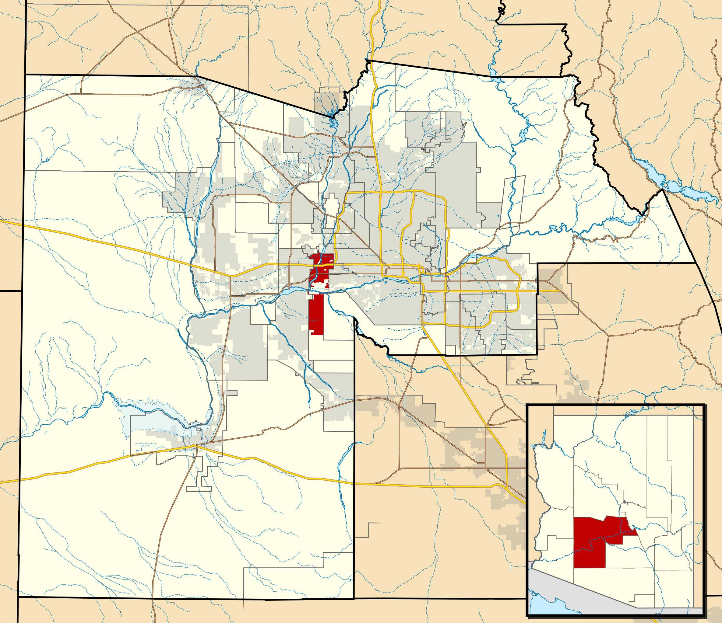
| Beskrivning | This map shows the incorporated areas and Indian reservation boundaries in Maricopa County, Arizona, along with water bodies and major highways and roads. Avondale is highlighted in red. Other incorporated cities are shown in gray, planning area borders for these cities and Indian reservation borders are shown as solid black lines. Changes from Previous Version: Updated the maps to include water bodies and to make "less boring" than the plain black/white/gray maps. Format was updated to match standards laid out by WikiProject Maps/Conventions. Map data is based on data from the following Webpage: Maricopa County Interactive GIS Map. I created this map in Inkscape. |
| Datum | |
| Källa | My own work, based on government information |
| Skapare | Ixnayonthetimmay |
| Tillstånd (Återanvändning av denna fil) |
Public Domain |
| Andra versioner | See Category:Maps of Maricopa County for other versions of this image. |
Licensiering
| Jag, upphovsrättsinnehavaren till detta verk, släpper detta verk i public domain. Detta gäller globalt. I vissa länder kan detta inte vara juridiskt möjligt; i så fall: Jag ger härmed envar rätten att använda detta verk för alla ändamål, utan några villkor, förutom villkor som lagen ställer. |
Filhistorik
Klicka på ett datum/klockslag för att se filen som den såg ut då.
| Datum/Tid | Miniatyrbild | Dimensioner | Användare | Kommentar | |
|---|---|---|---|---|---|
| nuvarande | 20 maj 2011 kl. 08.08 | | 940 × 812 (1,05 Mbyte) | Ixnayonthetimmay | Uploading new version |
| 30 augusti 2008 kl. 05.55 |  | 900 × 800 (413 kbyte) | Ixnayonthetimmay | == Summary == {{Information |Description=This map shows the incorporated areas and unincorporated areas in Maricopa County, Arizona. [[:en:Avondale, Arizona| | |
| 16 september 2007 kl. 02.14 |  | 900 × 800 (384 kbyte) | Ixnayonthetimmay | {{Information |Description= |Source= |Date= |Author= |Permission= |other_versions= }} | |
| 28 maj 2007 kl. 11.49 |  | 900 × 780 (329 kbyte) | Ixnayonthetimmay | ||
| 22 maj 2007 kl. 01.47 |  | 900 × 780 (318 kbyte) | Ixnayonthetimmay | ||
| 30 januari 2007 kl. 06.02 |  | 904 × 758 (177 kbyte) | Ixnayonthetimmay | {{Information |Description=This map shows the incorporated areas in Maricopa County, Arizona, highlighting Avondale in red. It also shows the boundaries for the | |
| 30 januari 2007 kl. 06.00 |  | 904 × 758 (177 kbyte) | Ixnayonthetimmay | {{Information |Description=This map shows the incorporated areas in Maricopa County, Arizona, highlighting Avondale in red. It also shows the boundaries for the |
Filanvändning
Följande sida använder den här filen:
Global filanvändning
Följande andra wikier använder denna fil:
- Användande på ar.wikipedia.org
- Användande på arz.wikipedia.org
- Användande på ca.wikipedia.org
- Användande på ceb.wikipedia.org
- Användande på cy.wikipedia.org
- Användande på de.wikipedia.org
- Användande på eu.wikipedia.org
- Användande på fa.wikipedia.org
- Användande på fr.wikipedia.org
- Användande på ht.wikipedia.org
- Användande på io.wikipedia.org
- Användande på no.wikipedia.org
- Användande på pt.wikipedia.org
- Användande på ro.wikipedia.org
- Användande på sr.wikipedia.org
- Användande på sw.wikipedia.org
- Användande på tr.wikipedia.org
- Användande på tt.wikipedia.org
- Användande på ur.wikipedia.org
- Användande på vo.wikipedia.org
- Användande på www.wikidata.org
- Användande på zh-min-nan.wikipedia.org