
Fil:NCyprus districts named.png

Det finns ingen version med högre upplösning.
NCyprus_districts_named.png (600 × 365 pixlar, filstorlek: 47 kbyte, MIME-typ: image/png)
| Denna fil tillhandahålls av Wikimedia Commons. Informationen nedan är kopierad från dess filbeskrivningssida. |
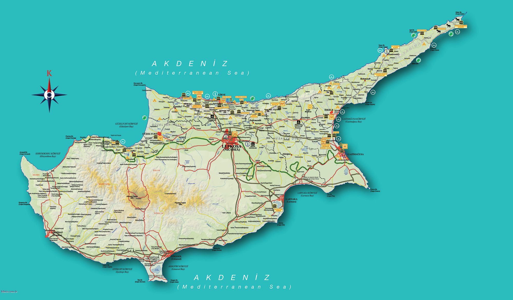
| Beskrivning | Map of the districts of Cyprus, with English annotations, and showing the Turkish Republic of Northern Cyprus, United Kingdom Sovereign Base Areas, and United Nations buffer zone. The TRNC section illustrates the current de facto district boundaries following this map as a guide. The northern districts are labelled in Turkish. | |||
| Datum | (UTC) | |||
| Källa | ||||
| Skapare |
|
|||
| Andra versioner |
|


Jag, upphovsrättsinnehavaren av detta verk, publicerar härmed det under följande licenser:
Denna fil har gjorts tillgänglig under licenserna Creative Commons Erkännande-Dela Lika 2.5 Generisk, 2.0 Generisk och 1.0 Generisk.
- Du är fri:
- att dela – att kopiera, distribuera och sända verket
- att remixa – att skapa bearbetningar
- På följande villkor:
- erkännande – Du måste ge lämpligt erkännande, ange en länk till licensen och indikera om ändringar har gjorts. Du får göra det på ett lämpligt sätt, men inte på ett sätt som antyder att licensgivaren stödjer dig eller din användning.
- dela lika – Om du remixar, transformerar eller bygger vidare på materialet måste du distribuera dina bidrag under samma eller en kompatibel licens som originalet.

|
Tillstånd ges att kopiera, distribuera och/eller modifiera detta dokument under villkoren i GNU Free Documentation License, Version 1.2 eller senare version publicerad av Free Software Foundation, utan oföränderliga avsnitt, framsidestexter eller baksidestexter. En kopia av licensen ingår i avsnittet GNU Free Documentation License. |
| Denna fil har gjorts tillgänglig under licensen Creative Commons Erkännande-Dela Lika 3.0 Generisk | ||
| ||
| Detta licenstillägg lades till till denna fil som en del av GFDL:s licensuppdatering. |
Du får själv välja den licens du vill använda.
Ursprunglig uppladdningslogg
This image is a derivative work of the following images:
- Image:Cyprus_districts_named.png licensed with Cc-by-sa-2.5,2.0,1.0, GFDL
- 2007-08-13T14:28:15Z Lexicon 600x365 (22511 Bytes) Reverted to earlier revision
- 2007-08-13T14:28:03Z Lexicon 600x365 (55202 Bytes) buffer zone and SBA colours flipped, since buffer zone is called the "Green Line"
- 2005-06-30T06:07:58Z Golbez 600x365 (22511 Bytes) Got Dhekelia wrong again. Final version unless others have comments.
- 2005-06-28T02:04:32Z Golbez 600x365 (22795 Bytes) Updated again, final version for now, cleaned up text and the Dhekelia area.
- 2005-06-27T17:51:02Z Golbez 600x365 (20527 Bytes) Fixed a color
- 2005-06-27T17:44:36Z Golbez 600x365 (20529 Bytes) Updated map with different color for north and south, and enclaves in Dhekelia.
- 2005-06-27T09:48:54Z Golbez 600x365 (19121 Bytes) Map of the districts of [[Cyprus]] Source: Made by [[User:Golbez]]. {{cc-by-sa-2.0}} [[Category:Maps of Cyprus]]\
Uploaded with derivativeFX
Filhistorik
Klicka på ett datum/klockslag för att se filen som den såg ut då.
| Datum/Tid | Miniatyrbild | Dimensioner | Användare | Kommentar | |
|---|---|---|---|---|---|
| nuvarande | 18 september 2008 kl. 15.34 | | 600 × 365 (47 kbyte) | QuartierLatin1968 | {{Information |Description=Map of the districts of Cyprus, with English annotations, and showing the Turkish Republic of Northern Cyprus, United Kingdom Sovereign Base Areas, and United Nations buffer zone. The TRNC section illustrates the current ''de fa |
Filanvändning
Följande sida använder den här filen:
Global filanvändning
Följande andra wikier använder denna fil:
- Användande på am.wikipedia.org
- Användande på ar.wikipedia.org
- Användande på arz.wikipedia.org
- Användande på ba.wikipedia.org
- Användande på be.wikipedia.org
- Användande på bg.wikipedia.org
- Användande på de.wikipedia.org
- Användande på el.wikipedia.org
- Användande på en.wikipedia.org
- Användande på fr.wikipedia.org
- Användande på gl.wikipedia.org
- Användande på it.wikivoyage.org
- Användande på la.wikipedia.org
- Användande på mk.wikipedia.org
- Användande på mrj.wikipedia.org
- Användande på pt.wikipedia.org
- Användande på ru.wikipedia.org
- Användande på sc.wikipedia.org
- Användande på simple.wikipedia.org
- Användande på sk.wikipedia.org
- Användande på sr.wikipedia.org
- Användande på tg.wikipedia.org
- Användande på tr.wikipedia.org
- Användande på uk.wikipedia.org
- Användande på vi.wikipedia.org
- Användande på zh.wikipedia.org