
Fil:Stillwater Minnesota waterfront aerial view.jpg

Storlek på förhandsvisningen: 749 × 600 pixlar. Andra upplösningar: 300 × 240 pixlar | 600 × 480 pixlar | 959 × 768 pixlar | 1 279 × 1 024 pixlar | 1 500 × 1 201 pixlar.
Originalfil (1 500 × 1 201 pixlar, filstorlek: 1,05 Mbyte, MIME-typ: image/jpeg)
| Denna fil tillhandahålls av Wikimedia Commons. Informationen nedan är kopierad från dess filbeskrivningssida. |
| Beskrivning |
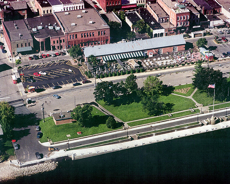
English: Aerial view of part of the waterfront section of Stillwater, Minnesota, USA, on the St. Croix River. View is to the west. The U.S. Army Corps of Engineers has constructed a floodwall along the waterfront. |
|||
| Datum | Bild tagen: 24 augusti 1999 | |||
| Källa |
U.S. Army Corps of Engineers Digital Visual Library Image page Image description page Digital Visual Library home page |
|||
| Skapare | U.S. Army Corps of Engineers, photographer not specified or unknown | |||
| Tillstånd (Återanvändning av denna fil) |
|
|||
| Plats | Stillwater, Washington County, Minnesota, USA |
| Kameraposition | | Se denna och andra närliggande bilder på: OpenStreetMap |
|---|
Filhistorik
Klicka på ett datum/klockslag för att se filen som den såg ut då.
| Datum/Tid | Miniatyrbild | Dimensioner | Användare | Kommentar | |
|---|---|---|---|---|---|
| nuvarande | 7 april 2007 kl. 02.08 | | 1 500 × 1 201 (1,05 Mbyte) | DanMS | {{Information | Description = {{en|Aerial view of part of the waterfront section of Stillwater, Minnesota, USA, on the St. Croix River. View is to the west. The U.S. Army Corps of Engineers has constructed a floodwall along the waterfront.}} | |
Filanvändning
Följande sida använder den här filen:
Global filanvändning
Följande andra wikier använder denna fil:
- Användande på ar.wikipedia.org
- Användande på arz.wikipedia.org
- Användande på azb.wikipedia.org
- Användande på ca.wikipedia.org
- Användande på ceb.wikipedia.org
- Användande på ce.wikipedia.org
- Användande på dag.wikipedia.org
- Användande på en.wikipedia.org
- Användande på en.wikivoyage.org
- Användande på es.wikipedia.org
- Användande på eu.wikipedia.org
- Användande på fa.wikipedia.org
- Användande på fi.wikipedia.org
- Användande på fr.wikipedia.org
- Användande på he.wikivoyage.org
- Användande på ht.wikipedia.org
- Användande på hu.wikipedia.org
- Användande på ko.wikipedia.org
- Användande på ky.wikipedia.org
- Användande på lld.wikipedia.org
- Användande på no.wikipedia.org
- Användande på pl.wikipedia.org
- Användande på ru.wikipedia.org
- Användande på sh.wikipedia.org
- Användande på sr.wikipedia.org
- Användande på tr.wikipedia.org
- Användande på tt.wikipedia.org
- Användande på uk.wikipedia.org
- Användande på uz.wikipedia.org
- Användande på vi.wikipedia.org
- Användande på vo.wikipedia.org
- Användande på www.wikidata.org
- Användande på zh-min-nan.wikipedia.org
- Användande på zh.wikipedia.org