
Fil:USGS 1950s mapping field camp.jpg

Storlek på förhandsvisningen: 800 × 497 pixlar. Andra upplösningar: 320 × 199 pixlar | 640 × 398 pixlar | 1 024 × 637 pixlar | 1 280 × 796 pixlar | 2 672 × 1 661 pixlar.
Originalfil (2 672 × 1 661 pixlar, filstorlek: 3,5 Mbyte, MIME-typ: image/jpeg)
| Denna fil tillhandahålls av Wikimedia Commons. Informationen nedan är kopierad från dess filbeskrivningssida. |
Sammanfattning
| Beskrivning |
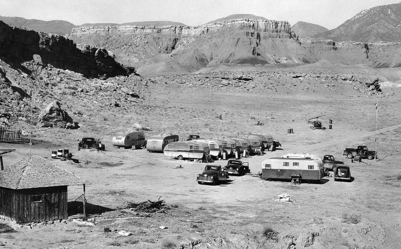
English: A typical USGS mapping field camp. Note the helicopter parked near the trailers. Helicopters were first used by the USGS for topographic mapping in Death Valley in 1948. (Description from USGS.) |
| Datum | c:a 1950 till 1955 |
| Källa | USGS Historical Photographs: Mapping Field Camp: http://online.wr.usgs.gov/outreach/historicPhotos/enlarged/mapping_camp_1950.html |
| Skapare | US Geological Survey |
Licensiering
This image is in the public domain in the United States because it only contains materials that originally came from the United States Geological Survey, an agency of the United States Department of the Interior. For more information, see the official USGS copyright policy.
|
Filhistorik
Klicka på ett datum/klockslag för att se filen som den såg ut då.
| Datum/Tid | Miniatyrbild | Dimensioner | Användare | Kommentar | |
|---|---|---|---|---|---|
| nuvarande | 30 januari 2009 kl. 22.50 | | 2 672 × 1 661 (3,5 Mbyte) | Awickert | {{Information |Description={{en|1=A typical USGS mapping field camp. Note the helicopter parked near the trailers. Helicopters were first used by the USGS for topographic mapping in Death Valley in 1948. (Description from USGS.)}} |Source=USGS Historical |
Filanvändning
Följande sida använder den här filen:
Global filanvändning
Följande andra wikier använder denna fil:
- Användande på en.wikipedia.org
- Användande på la.wikipedia.org
- Användande på vi.wikipedia.org