
Fil:AS17-M-0443.jpg
Originalfil (1 012 × 1 012 pixlar, filstorlek: 258 kbyte, MIME-typ: image/jpeg)
| Denna fil tillhandahålls av Wikimedia Commons. Informationen nedan är kopierad från dess filbeskrivningssida. |
Sammanfattning
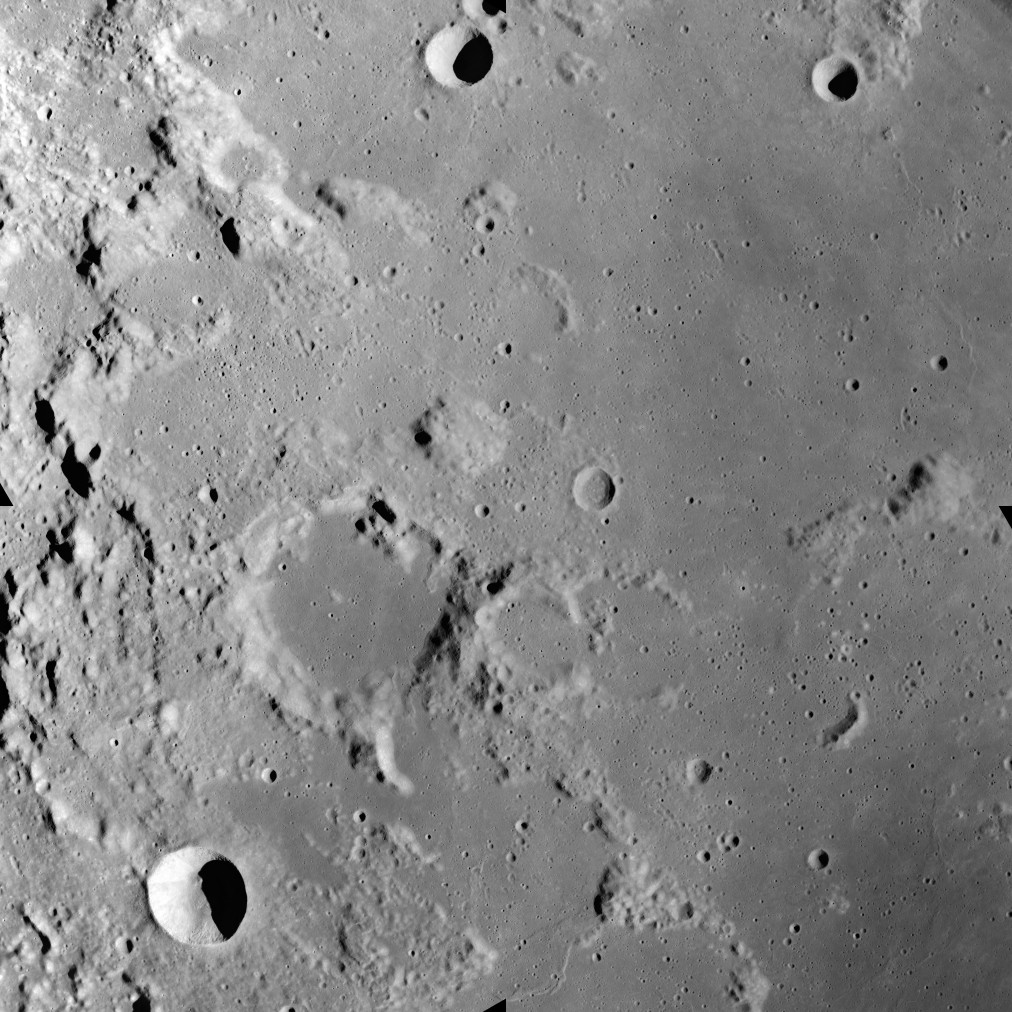
This image was taken during the Apollo 17 mapping metric sequence, revolution #14. The selenographic coordinates of this image are 20° N, 35.90° E.
At the center of this image is the dome-like Mons Maraldi, and just to the southwest is the flooded Maraldi crater. Most of the eastern half of this view is occupied by the Sinus Amoris, a lunar mare, and the flooded remnants of older formations. The bowl-shaped crater in the southwest corner is Gardner, and the cup-shaped crater at top-center is Franck.
This picture was produced by reducing a Hi-res image to 25% of full size, then rotating 90° counter-clockwise so that north is toward the top edge.
Source: Lunar & Planetary Institute, http://www.lpi.usra.edu/resources/apollo/frame/?AS17-M-0443 [1]
Licensiering
| Denna fil är allmän egendom eftersom den skapades av NASA. NASA:s upphovsrättspolicy hävdar att "material från NASA inte är upphovsrättsskyddad om inte annat anges". (Se Template:PD-USGov, NASA:s upphovsrättspolicy eller JPL-bildanvändningspolicy.) | ||
 |
Varningar:
|
Filhistorik
Klicka på ett datum/klockslag för att se filen som den såg ut då.
| Datum/Tid | Miniatyrbild | Dimensioner | Användare | Kommentar | |
|---|---|---|---|---|---|
| nuvarande | 19 juni 2018 kl. 22.22 | | 1 012 × 1 012 (258 kbyte) | Jstuby | higher resolution, better quality, from ASU |
| 27 januari 2006 kl. 19.58 |  | 601 × 600 (90 kbyte) | RJHall | Maraldi crater and surroundings from Apollo 17. |
Filanvändning
Följande sida använder den här filen:
Global filanvändning
Följande andra wikier använder denna fil:
- Användande på ca.wikipedia.org
- Användande på ce.wikipedia.org
- Användande på da.wikipedia.org
- Användande på de.wikipedia.org
- Användande på en.wikipedia.org
- Användande på es.wikipedia.org
- Användande på fa.wikipedia.org
- Användande på fr.wikipedia.org
- Användande på io.wikipedia.org
- Användande på it.wikipedia.org
- Användande på lb.wikipedia.org
- Användande på pl.wikipedia.org
- Användande på ru.wikipedia.org
- Användande på tt.wikipedia.org
- Användande på www.wikidata.org
- Användande på zh.wikipedia.org