
Fil:BlankMap-USA-states-Canada-provinces, HI closer.svg

Storleken för denna PNG-förhandsvisning av denna SVG-fil: 512 × 512 pixlar. Andra upplösningar: 240 × 240 pixlar | 480 × 480 pixlar | 768 × 768 pixlar | 1 024 × 1 024 pixlar | 2 048 × 2 048 pixlar.
Originalfil (SVG-fil, standardstorlek: 512 × 512 pixlar, filstorlek: 104 kbyte)
| Denna fil tillhandahålls av Wikimedia Commons. Informationen nedan är kopierad från dess filbeskrivningssida. |
| Beskrivning |
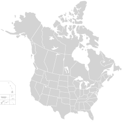
English: Blank SVG map of USA and Canada with state and province borders. Hawaii has been moved closer to the mainland USA to reduce width of image.
Non-contiguous parts of a states/provinces are "grouped" together with the main area of the state/provinces, so any state/provinces can be coloured in completion with one click anywhere on the state/provinces's area. Also, all states/provinces have a "id" attached to them, making them easy to find. Select "find" and then enter in the state/provinces's ISO 3166-2 code in the "id" field to find it. The codes can be found here (Canada) and here (USA). |
| Datum | |
| Källa |
Den här vektorbilden skapades med Inkscape och redigerades sedan manuellt . |
| Skapare | Lokal_Profil |
| Tillstånd (Återanvändning av denna fil) |
Denna fil har gjorts tillgänglig under licensen Creative Commons Erkännande-Dela Lika 2.5 Generisk Erkännande: Lokal_Profil
|
| Andra versioner |
Den här vektoriserade bilden innehåller hämtade eller omarbetade delar av den här filen:
The same as this map with the two-letter state or province name label for each one |
Filhistorik
Klicka på ett datum/klockslag för att se filen som den såg ut då.
| Datum/Tid | Miniatyrbild | Dimensioner | Användare | Kommentar | |
|---|---|---|---|---|---|
| nuvarande | 23 november 2020 kl. 03.48 | | 512 × 512 (104 kbyte) | Ponderosapine210 | Accidentally uploaded wrong version. Here is the correct one. |
| 23 november 2020 kl. 03.38 |  | 512 × 596 (132 kbyte) | Ponderosapine210 | Added the prominent islands of Manitoulin (Ontario) and Isle Royale (Michigan) to the Great Lakes. | |
| 2 juni 2019 kl. 00.59 |  | 512 × 512 (99 kbyte) | Fluffy89502 | added territories | |
| 8 december 2007 kl. 23.18 |  | 1 730 × 1 730 (212 kbyte) | Lokal Profil | Code trimming | |
| 3 juli 2007 kl. 06.21 |  | 1 730 × 1 730 (213 kbyte) | Lokal Profil | {{Information |Description={{en|Blank SVG map of USA and Canada with state and province borders. Hawaii has been moved closer to the mainland USA to reduce width of image.}} Non-contiguous parts of a states/provinces are "grouped" together with the main a |
Filanvändning
Inga sidor använder den här filen.
Global filanvändning
Följande andra wikier använder denna fil:
- Användande på en.wikipedia.org
- Användande på fr.wikipedia.org