
Fil:Europe map Napoleon 1811.svg

Storleken för denna PNG-förhandsvisning av denna SVG-fil: 415 × 422 pixlar. Andra upplösningar: 236 × 240 pixlar | 472 × 480 pixlar | 755 × 768 pixlar | 1 007 × 1 024 pixlar | 2 014 × 2 048 pixlar.
Originalfil (SVG-fil, standardstorlek: 415 × 422 pixlar, filstorlek: 89 kbyte)
| Denna fil tillhandahålls av Wikimedia Commons. Informationen nedan är kopierad från dess filbeskrivningssida. |

.jpg)
Sammanfattning
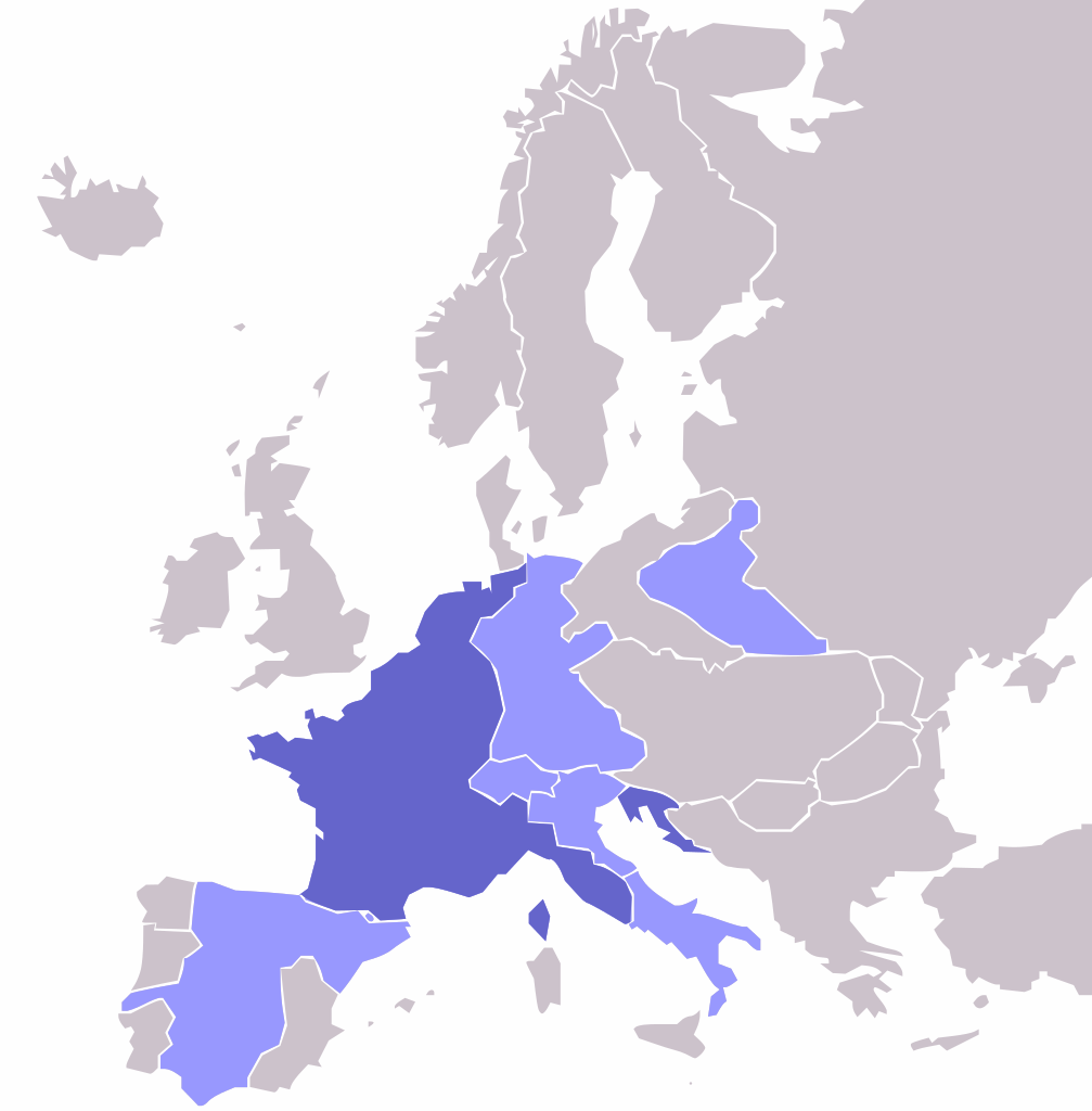
| Beskrivning | Map of the w:First French Empire and satellite states, with w:1811 borders. Created by User:OwenBlacker from Image:Europe blank map.png, therefore they are the source. |
| Datum | (UTC) |
| Källa | |
| Skapare |
|
| Andra versioner | File:Europe map Napoleon 1811.png |
Licensiering
| Jag, upphovsrättsinnehavaren till detta verk, släpper detta verk i public domain. Detta gäller globalt. I vissa länder kan detta inte vara juridiskt möjligt; i så fall: Jag ger härmed envar rätten att använda detta verk för alla ändamål, utan några villkor, förutom villkor som lagen ställer. |
Ursprunglig uppladdningslogg
This image is a derivative work of the following images:
- File:Europe_map_Napoleon_1811.png licensed with PD-self
- 2006-10-16T00:53:12Z Deltabeignet 415x422 (13615 Bytes) Corrected status of Illyrian provinces.
- 2005-08-21T00:51:11Z OwenBlacker 415x422 (11762 Bytes) Map of the [[w:First French Empire]] and satellite states, with [[w:1811]] borders. Created by [[User:OwenBlacker]] from [[:Image:Europe blank map.png]] {{GFDL}} {{cc-by-sa-2.0-uk}}
Uploaded with derivativeFX
| Annotations | This image is annotated: View the annotations at Commons |
Filhistorik
Klicka på ett datum/klockslag för att se filen som den såg ut då.
| Datum/Tid | Miniatyrbild | Dimensioner | Användare | Kommentar | |
|---|---|---|---|---|---|
| nuvarande | 3 maj 2009 kl. 01.14 | | 415 × 422 (89 kbyte) | Mnmazur | {{Information |Description=Map of the w:First French Empire and satellite states, with w:1811 borders. Created by User:OwenBlacker from Image:Europe blank map.png, therefore they are the source. |Source=*[[:File:Europe_map_Napoleon_1811.p |
Filanvändning
Följande sida använder den här filen:
Global filanvändning
Följande andra wikier använder denna fil:
- Användande på ba.wikipedia.org
- Användande på es.wikipedia.org
- Användande på et.wikipedia.org
- Användande på fr.wikipedia.org
- Användande på hi.wikipedia.org
- Användande på hu.wikipedia.org
- Användande på hy.wikipedia.org
- Användande på no.wikipedia.org
- Användande på pl.wikipedia.org
- Användande på ru.wikipedia.org
- Användande på sr.wikipedia.org
- Användande på tl.wikipedia.org
- Användande på tt.wikipedia.org
- Användande på uk.wikipedia.org
- Användande på yo.wikipedia.org
- Användande på zh-min-nan.wikipedia.org