
Fil:Ince Castle - geograph.org.uk - 344828.jpg
Ince_Castle_-_geograph.org.uk_-_344828.jpg (640 × 435 pixlar, filstorlek: 63 kbyte, MIME-typ: image/jpeg)
| Denna fil tillhandahålls av Wikimedia Commons. Informationen nedan är kopierad från dess filbeskrivningssida. |
Sammanfattning
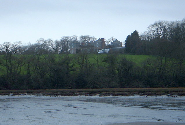
| Beskrivning |
English: Ince Castle This is Ince Castle which was built in 1642 at the start of the Civil War and was captured in 1646. It consists of 4 three storey towers with walls 4 foot thick. By the 1850s it was used as a farm and was allowed to decay but it was restored in the early 20th century. It burnt down in 1986 (apparently by grandmother being a bit irresponsible with a candle) - but it has now been rebuilt.
In 1649, John Killigrew inherited Ince Castle from an uncle. He married four wives and installed them separately into each of the four towers giving them a story that the fields were plagued with mice - which kept them inside. For some time, each of the four ladies lived happily in ignorance of the other three, until a thicko servant delivered a letter to the wrong wife, and all was revealed! John Killigrew was sentenced to sixteen years, four years for each count of bigamy. John pointed out to the judge that, as his first marriage was not bigamous, he should serve only twelve years! Good lad. It is now the home of Lord and Lady Boyd who probably wouldn't like to see me making footprints in their ever so posh mud. |
| Datum | |
| Källa | From geograph.org.uk |
| Skapare | Bill Booth |
| Andra versioner | Filer som bygger på denna fil: Ince Castle - geograph.org.uk - 344828 cropped.jpg |
| Kameraposition | | Se denna och andra närliggande bilder på: OpenStreetMap |
|---|
_heading:225.00&language=sv)
| Objektposition | | Se denna och andra närliggande bilder på: OpenStreetMap |
|---|
_heading:225.00&language=sv)
Licensiering

|
Denna bild togs från samlingen Geograph project. Se sidan till detta fotografi på Geographs webbplats för fotografens kontaktinformation. Upphovsrätten på denna sida ägs av Bill Booth och är licenserad för återanvändning under licensen Creative Commons Attribution-DelaLika 2.0.
|
- Du är fri:
- att dela – att kopiera, distribuera och sända verket
- att remixa – att skapa bearbetningar
- På följande villkor:
- erkännande – Du måste ge lämpligt erkännande, ange en länk till licensen och indikera om ändringar har gjorts. Du får göra det på ett lämpligt sätt, men inte på ett sätt som antyder att licensgivaren stödjer dig eller din användning.
- dela lika – Om du remixar, transformerar eller bygger vidare på materialet måste du distribuera dina bidrag under samma eller en kompatibel licens som originalet.
Filhistorik
Klicka på ett datum/klockslag för att se filen som den såg ut då.
| Datum/Tid | Miniatyrbild | Dimensioner | Användare | Kommentar | |
|---|---|---|---|---|---|
| nuvarande | 2 januari 2011 kl. 19.18 | | 640 × 435 (63 kbyte) | GeographBot | == {{int:filedesc}} == {{Information |description={{en|1=Ince Castle This is Ince Castle which was built in 1642 at the start of the Civil War and was captured in 1646. It consists of 4 three storey towers with walls 4 foot thick. By the 1850s it was used |
Filanvändning
Följande sida använder den här filen:
Global filanvändning
Följande andra wikier använder denna fil:
- Användande på ceb.wikipedia.org
- Användande på dag.wikipedia.org
- Användande på da.wikipedia.org
- Användande på de.wikipedia.org
- Användande på en.wikipedia.org
- Användande på fr.wikipedia.org
- Användande på ru.wikipedia.org
- Användande på www.wikidata.org