
Fil:Trig. point at Ridley - geograph.org.uk - 151530.jpg
Det finns ingen version med högre upplösning.
Trig._point_at_Ridley_-_geograph.org.uk_-_151530.jpg (640 × 485 pixlar, filstorlek: 79 kbyte, MIME-typ: image/jpeg)
| Denna fil tillhandahålls av Wikimedia Commons. Informationen nedan är kopierad från dess filbeskrivningssida. |
Sammanfattning
| Beskrivning |
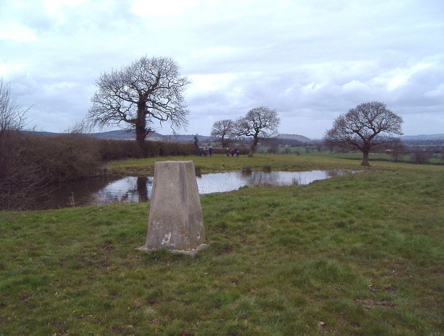
English: Trig. point at Ridley The view is to the NW. The trig. point (alt. 125m) lies just E of the A49 and just N of the A534 in the parish of Ridley. A telephone mast and covered reservoir lie just behind the photographer. This is the high point of the undulating land east of the Peckforton Hills and south of the Beeston Gap. The Peckforton Hills are seen in the distance, with Peckforton Castle on the central skyline 5 km away and Beeston Castle just visible on the skyline a little further to the right on its isolated hill nearly 6 km away. This part of Cheshire seems not to know whether it is supposed to be the Cheshire Plain or the sandstone hills and has a character of its own. |
| Datum | |
| Källa | From geograph.org.uk |
| Skapare | Mike Harris |
| Erkännande (krävs av licensen) | Mike Harris / Trig. point at Ridley / |
| Objektposition | | Se denna och andra närliggande bilder på: OpenStreetMap |
|---|
_heading:315.00&language=sv)
Licensiering

|
Denna bild togs från samlingen Geograph project. Se sidan till detta fotografi på Geographs webbplats för fotografens kontaktinformation. Upphovsrätten på denna sida ägs av Mike Harris och är licenserad för återanvändning under licensen Creative Commons Attribution-DelaLika 2.0.
|
Denna fil har gjorts tillgänglig under licensen Creative Commons Erkännande-Dela Lika 2.0 Generisk
Erkännande: Mike Harris
- Du är fri:
- att dela – att kopiera, distribuera och sända verket
- att remixa – att skapa bearbetningar
- På följande villkor:
- erkännande – Du måste ge lämpligt erkännande, ange en länk till licensen och indikera om ändringar har gjorts. Du får göra det på ett lämpligt sätt, men inte på ett sätt som antyder att licensgivaren stödjer dig eller din användning.
- dela lika – Om du remixar, transformerar eller bygger vidare på materialet måste du distribuera dina bidrag under samma eller en kompatibel licens som originalet.
- Remove redundant categories and try to put this image in the most specific category/categories
- Remove this template
- The location categories are based on information from this geonames tool and this OpenStreetMap tool combined with a database. You can also have a look at this tool from mysociety.
- The topic category from Geograph was Triangulation Pillar (find similar images Pillar at Geograph)
Filhistorik
Klicka på ett datum/klockslag för att se filen som den såg ut då.
| Datum/Tid | Miniatyrbild | Dimensioner | Användare | Kommentar | |
|---|---|---|---|---|---|
| nuvarande | 31 januari 2010 kl. 13.53 | | 640 × 485 (79 kbyte) | GeographBot | == {{int:filedesc}} == {{Information |description={{en|1=Trig. point at Ridley The view is to the NW. The trig. point (alt. 125m) lies just E of the A49 and just N of the A534 in the parish of Ridley. A telephone mast and covered reservoir lie just behind |
Filanvändning
Följande sida använder den här filen:
Global filanvändning
Följande andra wikier använder denna fil:
- Användande på ceb.wikipedia.org
- Användande på en.wikipedia.org
- Användande på fr.wikipedia.org
- Användande på it.wikipedia.org
- Användande på lld.wikipedia.org
- Användande på www.wikidata.org