
Fil:Western Indian Wars.jpg
Storlek på förhandsvisningen: 785 × 600 pixlar. Andra upplösningar: 314 × 240 pixlar | 629 × 480 pixlar | 1 006 × 768 pixlar | 1 280 × 978 pixlar | 2 006 × 1 532 pixlar.
Originalfil (2 006 × 1 532 pixlar, filstorlek: 425 kbyte, MIME-typ: image/jpeg)
| Denna fil tillhandahålls av Wikimedia Commons. Informationen nedan är kopierad från dess filbeskrivningssida. |
| Beskrivning |
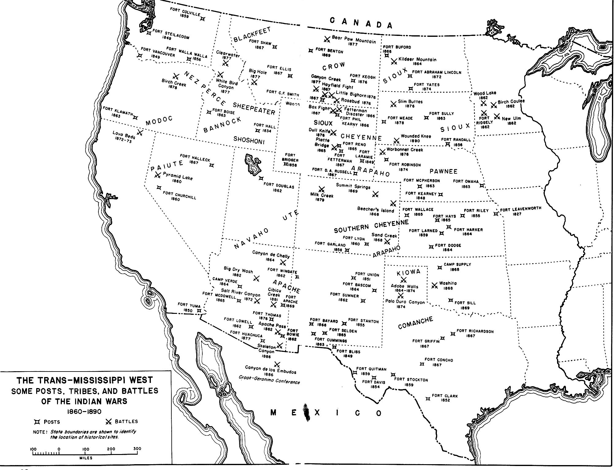
English: A map of the En:Indian Wars in the Western United States showing the general location of tribes and the location of some army posts and battles. Map 35 in Chapter 14 Winning the West: The Army in the Indian Wars, 1865-1890 AMERICAN MILITARY HISTORY ARMY HISTORICAL SERIES OFFICE OF THE CHIEF OF MILITARY HISTORY UNITED STATES ARMY |
|||
| Källa | http://www.history.army.mil/books/amh/Map14-35.jpg | |||
| Skapare | Work of the United States government | |||
| Tillstånd (Återanvändning av denna fil) |
|

Filhistorik
Klicka på ett datum/klockslag för att se filen som den såg ut då.
| Datum/Tid | Miniatyrbild | Dimensioner | Användare | Kommentar | |
|---|---|---|---|---|---|
| nuvarande | 26 juli 2009 kl. 03.35 | | 2 006 × 1 532 (425 kbyte) | Fred Bauder | {{Information |Description={{en|1=A map of the En:Indian Wars in the Western United States showing the general location of tribes and the location of some army posts and battles. Map 35 in Chapter 14 Winning the West: The Army in the Indian Wars, 1865 |
Filanvändning
Följande sida använder den här filen:
Global filanvändning
Följande andra wikier använder denna fil:
- Användande på ar.wikipedia.org
- Användande på ca.wikipedia.org
- Användande på en.wikipedia.org
- Användande på en.wikiquote.org
- Användande på fr.wikipedia.org
- Användande på tr.wikipedia.org
- Användande på uk.wikipedia.org