
Fil:Xinjiang Internment Map, US-Aus Gov Assessment.jpg
Storlek på förhandsvisningen: 800 × 495 pixlar. Andra upplösningar: 320 × 198 pixlar | 640 × 396 pixlar | 1 024 × 634 pixlar | 1 280 × 792 pixlar | 2 048 × 1 267 pixlar.
Originalfil (2 048 × 1 267 pixlar, filstorlek: 150 kbyte, MIME-typ: image/jpeg)
| Denna fil tillhandahålls av Wikimedia Commons. Informationen nedan är kopierad från dess filbeskrivningssida. |
Sammanfattning
| Beskrivning |
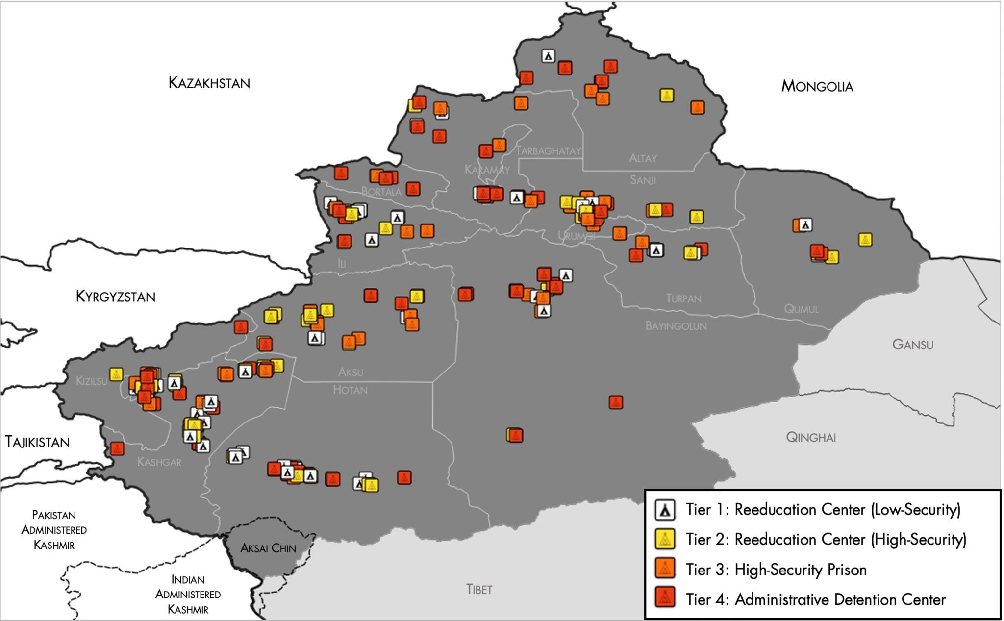
English: Map of the Xinjiang Internment Camps created by the RAND Corporation based on data collected by the US National Geospatial Intelligence Agency and the Australian Strategic Policy Institute. Open source here. |
||||||||
| Datum | |||||||||
| Källa | https://www.tearline.mil/public_page/xinjiang-nighttime-1/ | ||||||||
| Skapare | National Geospatial Intelligence Agency, using data from the Australian Strategic Policy Institute, and administrative boundaries from GADM. | ||||||||
| Tillstånd (Återanvändning av denna fil) |
|


Filhistorik
Klicka på ett datum/klockslag för att se filen som den såg ut då.
| Datum/Tid | Miniatyrbild | Dimensioner | Användare | Kommentar | |
|---|---|---|---|---|---|
| nuvarande | 2 maj 2021 kl. 07.05 | | 2 048 × 1 267 (150 kbyte) | Abovfold | Uploaded a work by {{w|National Geospatial Intelligence Agency}}, using data from the {{w|Australian Strategic Policy Institute}}, and administrative boundaries from {{w|GADM}}. from https://www.tearline.mil/public_page/xinjiang-nighttime-1/ with UploadWizard |
Filanvändning
Följande sida använder den här filen:
Global filanvändning
Följande andra wikier använder denna fil:
- Användande på ba.wikipedia.org
- Användande på br.wikipedia.org
- Användande på cs.wikipedia.org
- Användande på de.wikipedia.org
- Användande på el.wikipedia.org
- Användande på en.wikipedia.org
- Användande på es.wikipedia.org
- Användande på fi.wikipedia.org
- Användande på fr.wikipedia.org
- Användande på ga.wikipedia.org
- Användande på he.wikipedia.org
- Användande på km.wikipedia.org
- Användande på nl.wikipedia.org
- Användande på or.wikipedia.org
- Användande på pl.wikipedia.org
- Användande på pt.wikipedia.org
- Användande på ru.wikinews.org
- Användande på szl.wikipedia.org
- Användande på tr.wikipedia.org
- Användande på www.wikidata.org