Ashland, Kansas
Utseende
| Ashland | |
| city | |
| Land | |
|---|---|
| Delstat | Kansas |
| County | Clark County |
| Höjdläge | 602 m ö.h. |
| Koordinater | 37°11′19″N 99°45′56″V / 37.18861°N 99.76556°V |
| Yta | 4,35 km² (2010) |
| - land | 4,35 km² |
| - vatten | 0,0 km² |
| Folkmängd | 783 (2020) |
| Befolkningstäthet | 180 invånare/km² |
| Tidszon | CST (UTC-6) |
| - sommartid | CDT (UTC-5) |
| ZIP-kod | 67831 |
| Riktnummer | 620 |
| FIPS | 2002675 |
| Geonames | 4267710 |
|
Ortens läge i Kansas
| |
|
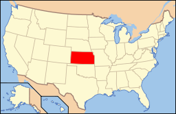
Kansas läge i USA
| |
| Webbplats: http://www.ashlandks.com/ | |
Ashland är administrativ huvudort i Clark County i Kansas.[1][2][3] Enligt 2020 års folkräkning hade Ashland 783 invånare.[4]
Källor
[redigera | redigera wikitext]- ^ Kansas County Map with County Seat Cities. Geology.com Geoscience News and Information. Läst 15 maj 2017.
- ^ Ashland, KS. Map Quest. Läst 15 maj 2017.
- ^ Profile for Ashland, Kansas. ePodunk. Läst 15 maj 2017.
- ^ ”2020 Decennial Census: Ashland city, Kansas” (på engelska). United States Census Bureau. https://data.census.gov/cedsci/profile?g=1600000US2002675. Läst 29 maj 2022.


