Burke County, Georgia
| Burke County | |
| County | |
Burke Countys domstolsbyggnad i Waynesboro.
| |
| Land | |
|---|---|
| Delstat | |
| Huvudort | Waynesboro |
| Största stad | Waynesboro |
| Area | 2 163 km² (2010)[1] |
| - land | 2 142 km² (99%) |
| - vatten | 20,8 km² (1%) |
| Folkmängd | 23 316 (2010)[2] |
| Befolkningstäthet | 11 invånare/km² |
| Grundat | 1777 |
| - uppkallat efter | Edmund Burke |
| Tidszon | EST (UTC-5) |
| - sommartid | EDT (UTC-4) |
| FIPS-kod | 13033 |
| Geonames | 4185265 |
 Läge i delstaten Georgia.
| |
|
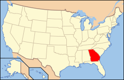
Delstatens läge i USA.
| |
Burke County är ett administrativt område i delstaten Georgia, USA. År 2010 hade countyt 23 316 invånare. Den administrativa huvudorten (county seat) är Waynesboro.
Geografi[redigera | redigera wikitext]
Enligt United States Census Bureau har countyt en total area på 2 163 km². 2 151 km² av den arean är land och 12 km² är vatten.
Angränsande countyn[redigera | redigera wikitext]
- Richmond County - nord
- Aiken County, South Carolina - nordost
- Barnwell County, South Carolina - nordöst
- Allendale County, South Carolina - öst
- Screven County - sydost
- Jenkins County - syd
- Emanuel County - sydväst
- Jefferson County - väst
Orter[redigera | redigera wikitext]
- Blythe (delvis i Richmond County)
- Girard
- Keysville
- Midville
- Sardis
- Vidette
- Waynesboro (huvudort)
Referenser[redigera | redigera wikitext]
- ^ ”2010 Census U.S. Gazetteer Files for Counties”. U.S. Census Bureau. Arkiverad från originalet den 5 juli 2012. https://www.webcitation.org/68vYLbou5?url=http://www.census.gov/geo/www/gazetteer/files/Gaz_counties_national.txt. Läst 5 juli 2012.
- ^ ”State & County QuickFacts, Burke County, Georgia” (på engelska). U.S. Census Bureau. Arkiverad från originalet den 7 juli 2011. https://www.webcitation.org/600INqclG?url=http://quickfacts.census.gov/qfd/states/13/13033.html. Läst 6 juli 2011.
|


