Brentwood, New Hampshire
| Brentwood | |
| Kommun (town) | |
| Land | |
|---|---|
| Delstat | |
| County | Rockingham County |
| Höjdläge | 35 m ö.h. |
| Koordinater | 42°58′43″N 71°4′22″V / 42.97861°N 71.07278°V |
| Area | 44 km² |
| Folkmängd | 4 490 (2020)[2] |
| Befolkningstäthet | 102 invånare/km² |
| Grundad | 1742[1] |
| Tidszon | EST (UTC-5) |
| - sommartid | EDT (UTC-4) |
| ZIP-kod | 03833 |
| Riktnummer | 603 |
| GNIS-kod | 873550 |
| Geonames | 5083780 5083783 |
|
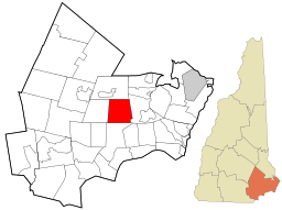
Översiktskarta
| |
|
New Hampshires läge i USA
| |
| Wikimedia Commons: Brentwood, New Hampshire | |
| Webbplats: https://www.brentwoodnh.gov/ | |
| Redigera Wikidata | |

Brentwood är en kommun (town) i Rockingham County i New Hampshire i USA med en yta av 44,0 km² och en befolkning som uppgår till 4 486 invånare (2010).[3] Brentwood är huvudort i Rockingham County.
Referenser[redigera | redigera wikitext]
Noter[redigera | redigera wikitext]
- ^ läs online, www.nhes.nh.gov , läst: 7 december 2021.[källa från Wikidata]
- ^ United States Census Bureau (red.), läs online, läst: 1 januari 2022.[källa från Wikidata]
- ^ ”Geographic Identifiers: 2010 Demographic Profile Data (G001): Brentwood town, Rockingham County, New Hampshire”. U.S. Census Bureau, American Factfinder. http://factfinder2.census.gov/bkmk/table/1.0/en/DEC/10_DP/G001/0600000US3301507220. Läst 31 januari 2013.
Externa länkar[redigera | redigera wikitext]
| ||||||||||


