Union, New Hampshire
Utseende
| Union | |
| CDP | |
Reunion Grange 303
| |
| Land | |
|---|---|
| Delstat | New Hampshire |
| County | Carroll County |
| Höjdläge | 148 m ö.h. |
| Koordinater | 43°29′29″N 71°1′23″V / 43.49139°N 71.02306°V |
| Yta | 0,8 km² (2010) |
| - land | 0,8 km² |
| - vatten | 0,0 km² |
| Folkmängd | 204 (2010) |
| Befolkningstäthet | 255 invånare/km² |
| Tidszon | EST (UTC-5) |
| - sommartid | EDT (UTC-4) |
| ZIP-kod | 03887 |
| Riktnummer | 603 |
| FIPS | 3377780 |
| Geonames | 5093975 |
|
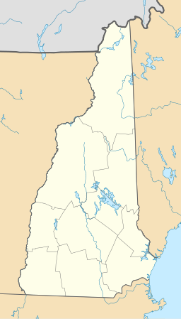
Ortens läge i New Hampshire
| |
|
New Hampshires läge i USA
| |
Union är en så kallad census-designated place i kommunen Wakefield i Carroll County i New Hampshire.[1] Vid 2010 års folkräkning hade Union 204 invånare.[2]
Källor[redigera | redigera wikitext]
- ^ Union, NH. Map Quest. Läst 25 juli 2021.
- ^ 2010 Census Population of Union, New Hampshire Arkiverad 25 juli 2021 hämtat från the Wayback Machine.. Census Viewer. Läst 25 juli 2021.


