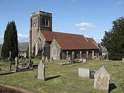
Caerphilly (kommun)
| Caerphilly | |
| Caerffili | |
| Kommun, county borough | |
| Officiellt namn: Caerphilly County Borough | |
| Land | |
|---|---|
| Riksdel | Wales |
| Bevarat grevskap | Gwent |
| Administrativ huvudort |
Hengoed |
| Yta | 278 km² |
| Folkmängd | 178 806 (2011)[1] |
| Befolkningstäthet | 643 invånare/km² |
| Tidszon | GMT (UTC+0) |
| - sommartid | BST (UTC+1) |
| Geonames | 3333240 |
Caerphilly (kymriska: Caerffili) är en kommun (principal area) med county borough-status i södra Wales. Det största befolkningscentrat i kommunen är Islwynområdet, med bland annat kommunens administrativa huvudkontor i Hengoed, medan den enskilt största orten är Caerphilly.
Kommunen upprättades den 1 april 1996 då distriktet Rhymney Valley i Mid Glamorgan slogs samman med Islwyn i Gwent.
Orter och communities i Caerphilly[redigera | redigera wikitext]
- Aber Valley
- Abercarn
- Abertridwr
- Abertysswg
- Argoed
- Bargoed
- Bedwas (community Bedwas, Trethomas and Machen)
- Blackwood
- Caerphilly
- Cefn Fforest
- Crosskeys
- Crumlin, Wales
- Cwmfelinfach
- Darran Valley
- Deri
- Fochriw
- Gelligaer
- Hengoed
- Llanbradach (community Llanbradach and Pwllypant)
- Machen
- Maesycwmmer
- Markham
- Nelson
- New Tredegar
- Newbridge
- Pen-twyn
- Pengam
- Penmaen
Källor[redigera | redigera wikitext]
- ^ ”Caerphilly Local Authority”. Office for National Statistics. https://www.nomisweb.co.uk/reports/localarea?compare=W06000018. Läst 7 juli 2022.
| |||||||


